Tide heights along the US west coast, Neah Bay, WA to San Diego, CA, plus the San Francisco Bay to Petaluma River branch. Heights are in feet above each station's local mean sea level, so the profile shows the tide wave moving north rather than differences in tidal range.
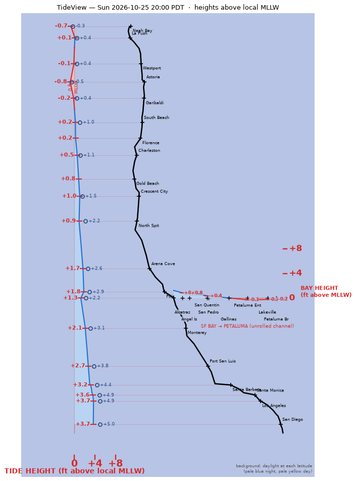
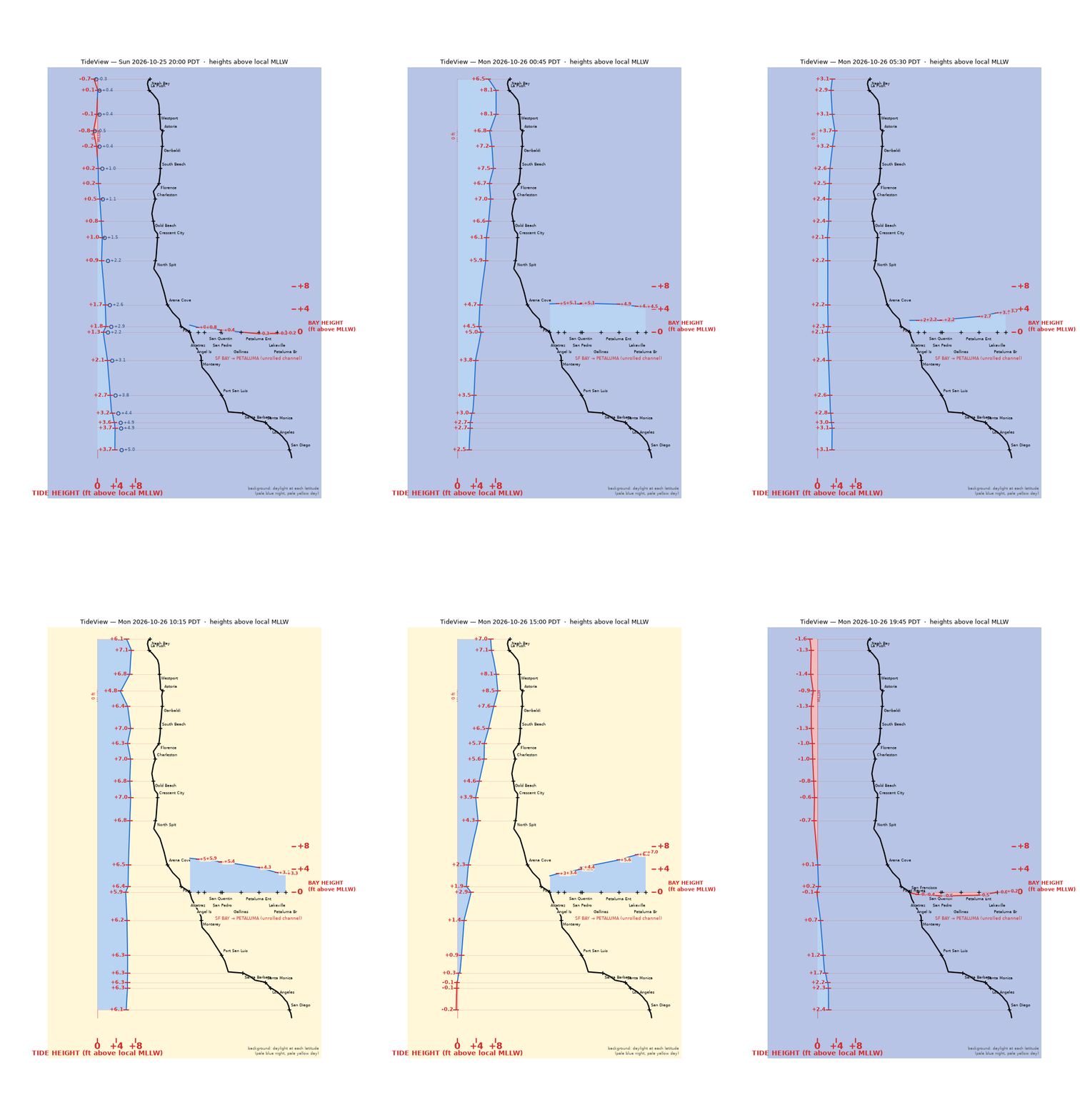
Data: NOAA CO-OPS predictions and preliminary real-time water levels. Observations are unverified. Not for navigation. Updated every 30 minutes.